|
Water Depth |
||||
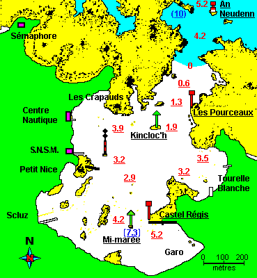 |
At half-tide level , the sea reaches the bottom
of the rock lying isolated in the southern part of the bay and carrying
a green starboard mark. These levels, derived from nautical charts, should be used with caution as they may vary depending on the movements of the sandbanks. |
|||